
A Swiss scholar website published a study that claims heat waves, like the one that took place recently in the Northwest United States, are caused by humans and have racial implications because it hurts certain populations.
MDPI published the study, authored by three people described as academics:
The increasing intensity, duration, and frequency of heat waves due to human-caused climate change puts historically underserved populations in a heightened state of precarity, as studies observe that vulnerable communities—especially those within urban areas in the United States—are disproportionately exposed to extreme heat.
Lacking, however, are insights into fundamental questions about the role of historical housing policies in cauterizing current exposure to climate inequities like intra-urban heat. Here, we explore the relationship between “redlining”, or the historical practice of refusing home loans or insurance to whole neighborhoods based on a racially motivated perception of safety for investment, with present-day summertime intra-urban land surface temperature anomalies.
Through a spatial analysis of 108 urban areas in the United States, we ask two questions: (1) how do historically redlined neighborhoods relate to current patterns of intra-urban heat? and (2) do these patterns vary by U.S. Census Bureau region? Our results reveal that 94 percent of studied areas display consistent city-scale patterns of elevated land surface temperatures in formerly redlined areas relative to their non-redlined neighbors by as much as 7 degrees C. Regionally, Southeast and Western cities display the greatest differences while Midwest cities display the least. Nationally, land surface temperatures in redlined areas are approximately 2.6 degrees C warmer than in non-redlined areas. While these trends are partly attributable to the relative preponderance of impervious land cover to tree canopy in these areas, which we also examine, other factors may also be driving these differences. This study reveals that historical housing policies may, in fact, be directly responsible for disproportionate exposure to current heat events.
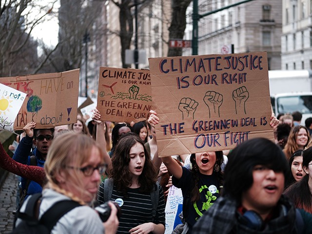
Students march to the Museum of Natural History to protest the lack of action on global warming and other climate-related issues on March 15, 2019, in New York City. (Spencer Platt/Getty Images)
The NBC affiliate in Seattle, King 5, reported on the study by featured a woman who goes by the name Byrd and agrees with the idea that racism is connected to how people are threatened by so-called climate change:
Places with less tree canopy, more pavement, and large buildings retain heat, creating urban heat islands as you find in Portland’s Albina area. That’s where Byrd’s family has roots.
Part of that layered issue involves redlining. Redlining is illegal today, but in the 1930s and for the several decades that followed it was a common discriminatory practice of disinvestment with lenders being discouraged from issuing mortgages in certain neighborhoods. In Portland and many other cities including Seattle, banks used a map to highlight what they considered the city’s “best” areas in green and “hazardous” areas in red. Albina, with a large black population at the time, was formerly redlined with the hazard being listed as “racial.”
Back then, there were also restrictions on where communities of color could live because of covenants. Kayin Talton Davis works for a nonprofit called Albina Vision Trust. She said that covenants would say things like “no Negro, no Mexicans, no Japanese could buy a home.”
“Right now, Lower Albina is mostly concrete, and concrete definitely holds more heat,” Talton Davis, who lives in Albina with her husband Cleo, said in the King 5 article.
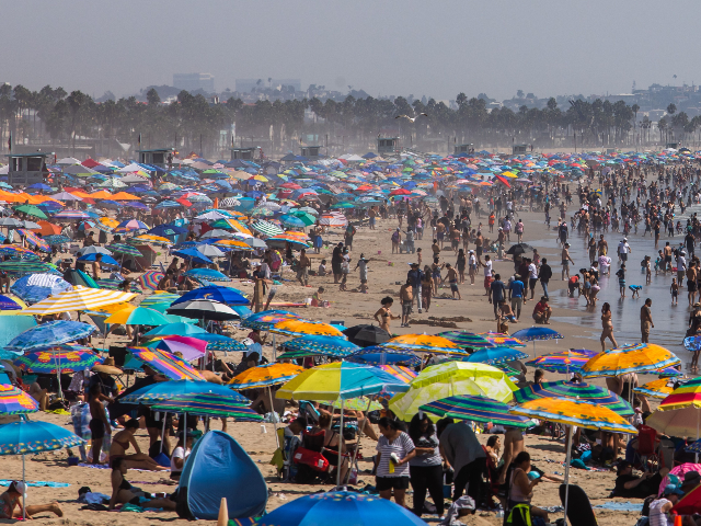
People gather on the beach on the second day of the Labor Day weekend amid a heatwave in Santa Monica, California, on September 6, 2020. (Apu Gomes/AFP via Getty Images)
“Between the 1950s and 60s is when the Oregon Department of Transportation began running highways, I-5 through the neighborhood,” Cleo Davis said.“Just ran a trench right through our neighborhood.”
Follow Penny Starr on Twitter or send news tips to pstarr@breitbart.com.
COMMENTS
Please let us know if you're having issues with commenting.