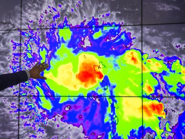
Hurricane Dorian, now an “extremely dangerous” Category 4 storm, could now only skirt Florida on its northern trek, but the storm still has the Bahamas in its sights.
The National Hurricane Center said on Saturday morning that the storm is packing 145 miles per hour winds and could impact the northern Bahamas on Sunday and Monday.
But even without a direct hit, Florida would still be in the cone of the storm if forecasts hold.
“We’re not out of the woods by any stretch, this needs to be watched and all Central Floridians need to be on guard until the storm rides north of our location,” Jaymer King, a meteorologist with WOFL-Fox 35 said in an Orlando Sentinel report:
The state’s east coast from Fort Lauderdale up to Cape Canaveral and inland to Orlando are still within the three-day cone of uncertainty, though. The five-day projection includes even more of the state, but the consensus path now has the storm headed for landfall near the South Carolina and Georgia border.
Hurricane-force winds extend out 30 miles from the storm’s center with tropical-storm-force winds extending out 105 miles. The current forecast has the center of the storm parked off Florida’s coast still as a Category 4 hurricane with 130 mph winds near Brevard County by Tuesday morning. It is then projected to head more north skirting Florida’s coast and diminish speed, but still a dangerous Category 3 level hurricane with 125 mph winds by Wednesday morning near St. Augustine.
The state will begin to feel tropical-storm-force winds, though, as early as midday Sunday with Orlando projected to feel those winds by Sunday night.
“Life-threatening storm surge and devastating hurricane-force winds are still possible along portions of the Florida east coast by the early to middle part of next week, but since Dorian is forecast to slow down and turn northward near the coast, it is too soon to determine when or where the highest surge and winds will occur,” the hurricane center’s website said.
“Floridians need to be prepared,” Florida Governor Ron DeSantis said in the Sentinel report. “The bad news of the storm going slower is that that could potentially have some negative impacts once it reaches landfall, but you do have time before it reaches to prepare if you have not done so.”
“Gas already became a premium with people filling up their cars and containers to refill generators — GasBuddy said 40 percent of Central Florida stations were without fuel,” the Sentinel reported. “DeSantis said the state was waiving weight restrictions and giving fuel tankers a police escort to resupply stations.”
The hurricane center said coastal areas in southeast Florida could get from six to 18 inches of rain.
Follow Penny Starr on Twitter


COMMENTS
Please let us know if you're having issues with commenting.