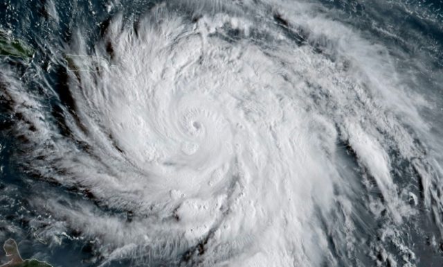
The U.S. Weather Service confirmed that 2017 was the costliest hurricane season in America’s history and forecast an above average year with 14 named storms for the 2018 season.
Colorado State University meteorology department released its 35th annual Tropical Meteorology Project hurricane forecast with an estimate of 14 named Atlantic storms and 3 major systems that may reach Category 3 or stronger on the Saffir-Simpson 5-step scale.
The annual Atlantic hurricane season begins on June 1 and December 31. An Atlantic storm gets a name when its winds reach tropical-storm strength at 39 miles. The most peak activity phase of the hurricane season tends to be during August and September.
CSU assigned an “elevated” probability of 63 percent that the continental United States will be hit by a Category 3 hurricane in 2018, compared to a 52 percent historical average.
CSU’s 2017 forecast predicted 11 named storms, with 4 becoming hurricanes and 2 major systems. But Mother Nature delivered 17 storms, 10 hurricanes, and 6 major systems.
Category 4 hurricanes Irma, Harvey, and Maria caused widespread devastation to Puerto Rico and the U.S. mainland 2017. Total hurricane financial losses in 2017 were $215 billion, according to Munich Re Corporate Climate Centre. That set the all-time loss record for the 146 years since the U.S. Weather Service began keeping records in 1871.
The western Equatorial Pacific experienced a cold water La Niña this winter, which brought widespread drought across California and the Southwest. But deep-water equatorial temperatures rising to neutral during March and early April brought 3 Pineapple Express storms, causing California to suffer heavy flooding and mud-slides.
Rains across Northern California’s Sierra Mountains were so intense on April 6 that Yosemite National Park was closed and over-flow warnings were issued for the partially rebuilt Oroville Dam.
Continued warming of Equatorial Pacific waters could fuel a flip to El Niño conditions that tend to cause torrential rains and massive mud-slide risks across California. A Pacific El Niño would also create wind shear conditions that would intensify Atlantic winds and further elevate the number of major hurricanes.
Lead meteorology forecaster Phil Klotzbach advised that April’s forecast is CSU’s least accurate because “changes from April to June can be pretty dramatic.” Klotzbach warned that weather forecasting is extremely challenging, “No one could say in early August last year we were going to witness the apocalypse.”

COMMENTS
Please let us know if you're having issues with commenting.