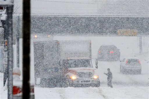
CHICAGO (AP) — After a brief respite of sunshine, winter returned to much of the nation’s midsection on Thursday, bringing a chilly mix of rain, sleet and snow, and at least one tornado.
The weather accelerated long-awaited melting and added to considerable runoff, raising concerns about flooding. Strong winds in central Illinois produced at least one tornado and 60 mph wind gusts that destroyed several farm buildings and knocked out power to thousands of people, according to the National Weather Service and local officials. There were no reports of injuries.
To the north, in Michigan’s Upper Peninsula, forecasters predicted as much as 13 inches of fresh snow could fall through Friday. Minnesota expected to get 8 to 10 inches.
The governor of Wisconsin declared a state of emergency ahead of a storm expected to dump more than a foot of snow in places, and some schools closed early.
On the East Coast, Vermont officials expressed the same worry that Michigan authorities voiced the day before: that wet, heavy snow could cause dangerous roof collapses.
The snow that piled up in Illinois during weeks of subzero temperatures started to melt in earnest as temperatures rose above freezing on Wednesday and Thursday. As work crews scrambled to clear catch basins of water to prevent flooding, some people took steps to make sure protect their belongings from any floodwaters. Emergency workers evacuated dozens of residents from a nursing home in Illinois’ Kankakee County as a precaution.
“It flooded in front of my house up to my boot,” said Lisa Robertson, a 50-year-old computer operator, after she got off a train in Chicago from her home in the south suburbs. “Last night, we made sure nothing was on the floor of the basement, (but) I’m worried about flooding when I get home.”
As of Thursday afternoon, those fears had not materialized.
“It seems like it rained less here than we expected, and we are not getting the flow of water and ice melt that we expected,” said Jim Zay, chairman of the Stormwater Management Planning Committee in DuPage County west of Chicago.
Meanwhile, river gauges along some of the nation’s biggest inland waterways — the Mississippi, Missouri and Ohio rivers — showed no immediate cause for alarm. Many of those rivers, traditionally low this time of year, were expected to rise into the middle of next week because of recent snowmelt and rainfall, though National Weather Service hydrologists say those water levels are still far below flood stage.
Even the fact that the rivers have not risen all that much has provoked worry.
“It tells us the water is trapped in the snowpack,” said Kent McKenzie, emergency management coordinator in Lake County in northern Illinois. “We are hoping the water gets to the rivers before tonight,” when the rivers could refreeze. “If it refreezes, it puts us at a higher risk of flooding when the temperatures do rise again.”
In the South, the storm threat came from a line of thunderstorms expected to begin forming from St. Louis to Texarkana, Ark., and then moving east, perhaps bringing damaging winds and tornadoes.
The tantalizing spell of mild temperatures will soon be gone. The National Weather Service predicted that temperatures in Illinois could fall as low as 12 degrees on Saturday night and as low as 6 degrees Sunday night.
Illinois State Police warned that the quick refreeze could result in slippery conditions on roadways and bridges.
“Even though you don’t see anything,” state police spokeswoman Monique Bond said, “it is treacherous.”
___
Associated Press Writer Jim Suhr in East St. Louis, Ill., contributed to this report.

COMMENTS
Please let us know if you're having issues with commenting.