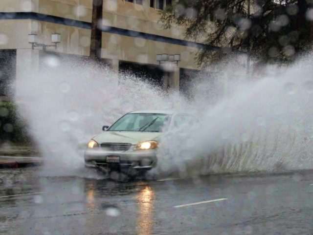
The third storm in a moisture-laden Pineapple Express hammered California on Sunday, setting off cell phone emergency alerts for flooding across the state.
The large, slow-moving low pressure center off of the West Coast has sucked in tropical atmospheric river driven by the jet stream that dumped 1 to 3 inches of rainfall on Sunday along the entire coast of California.
With Southern California annual rainfall averaging 14.93 inches over the last 100 years, the through storms through January 24 are expected to dump 3-6 inches of precipitation.
In the Sierra’s, Mammoth Mountain’s Main Lodge, at an altitude of 8,909 feet, expects about 25 inches of snow on Sunday and another 10 inches through Tuesday. By the time the storm breaks, America’s most popular ski area’s snowfall will have received 350 inches of snow this year and the snow pack will reach 180 inches.
Breitbart News reported on January 19 that California’s 5-year severe drought conditions had shrank from 42.66 percent of the state a year ago to just 2.13 percent as of January 10, according to the U.S. Drought Monitor. At that time, the last area of severe drought was centered mostly in Ventura County, but one of Sunday’s top rain and flooding alerts was for nearby Pacoima Dam.
With Northern California’s Shasta Lake filling at a rate of 57,000 cubic feet per second, the U.S. Bureau of Reclamation on January 12 opened the 5 huge drain pipes on the face of the 521-foot-high Shasta Dam for the first time in six years. But at a maximum release rate of 36,000 cubic feet per second, water will soon flood over the top of the dam.
The Bureau offered $1.1 billion to raise the height of Shasta Dam by 18.5 feet to increase water storage by 14 percent. But the Obama administration killed the project in 2014 by filing a 349-page report claiming any expansion would threaten salmon under the Endangered Species Act.
AccuWeather reported that flooding issues are becoming acute as across California as the soil becomes saturated. “Along with the threat of flash and urban flooding will be the high risk for additional mudslides and other debris flows in the canyons and mountainsides.” Senior Meteorologist Alex Sosnowski said. “Debris flows will not be limited to the recent wildfire areas.”
An added concern is that the third storm through Monday morning is an increasingly “strong surface low” that is expected to bring very strong winds that will down trees sitting in the saturated soil and cause power outages.


COMMENTS
Please let us know if you're having issues with commenting.