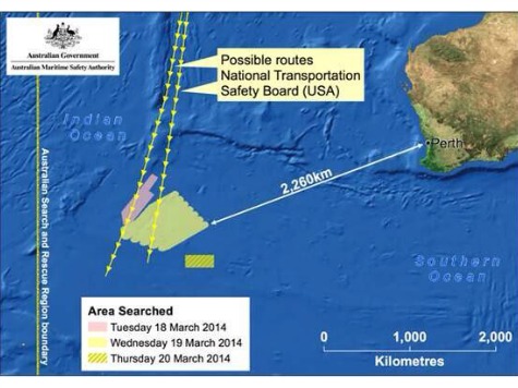
Telecommunications firm Inmarsat has said that the most likely crash site of missing Malaysia Airlines flight MH370 has still not been searched. The firm, which supplied the satellite data that helped search teams pin-point a number of potential search areas, say they have calculated a new “hot spot” in the southern Indian Ocean, according to the BBC.
The UK company generated the data from hourly electronic “pings” sent from the aircraft the their satellites. Using these pings they were able to calculate the likely flight path of the plane after it disappeared from radio contact.
An international search team originally focused on a region west of the Australian city of Perth, but according to the BBC’s Horizon programme, they never got to the most likely crash site as they were distracted by sonar readings some distance away that ultimately turned out not to be from the aircraft.
“It was by no means an unrealistic location but it was further to the north east than our area of highest probability,” Chris Ashton from Inmarsat told the programme.
Australian authorities will now make a high-resolution depth survey of a 23,000 sq mile (60,000 sq km) search area. This process could take several months, but once it is complete, they will be able to better chose the most appropriate method to continue the underwater search.
Flight MH370 has now been missing for three months. It disappeared while flying from Kuala Lumpur to Beijing on 8 March with 239 passengers and crew on board.

COMMENTS
Please let us know if you're having issues with commenting.