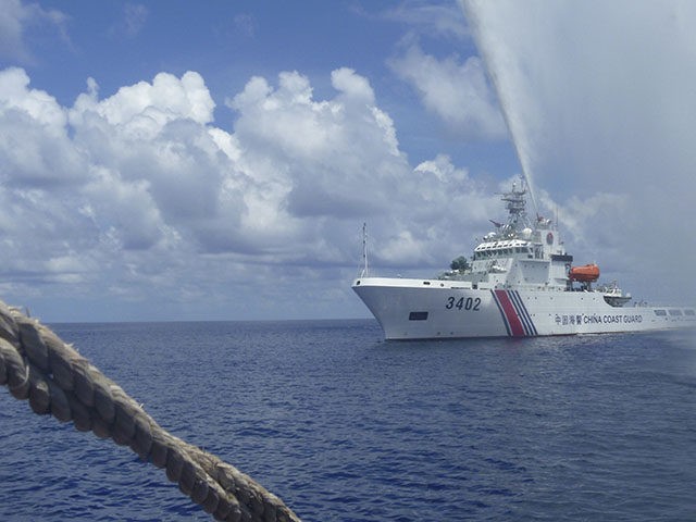
Indonesia’s foreign ministry lodged a formal protest with Beijing on Monday after a Chinese coastguard ship intruded into the country’s exclusive economic zone (EEZ) in the South China Sea for two straight days.
Indonesia’s maritime security agency (Bakamla) said that its KN Nipah 321 patrol ship first detected the Chinese vessel’s presence within Indonesia’s EEZ at around 10:00 a.m. on Saturday through an automatic identification system. The Chinese ship was patrolling the North Natuna Sea — part of the southernmost portion of the South China Sea — without authorization, Bakamala said, according to the Jakarta Post.
“[A]after arguing via radio,” with Bakamala, the Chinese vessel finally left Indonesia’s EEZ at around noon on Monday, the maritime agency said. It was escorted out of Natuna waters by an Indonesian patrol boat.
“[The Chinese coastguard] said they were patrolling in Chinese jurisdiction. We firmly rejected this and said this is our economic exclusive zone,” Bakamla spokesman Wisnu Pramandita told the South China Morning Post on Monday of the radio dispute.
Indonesian Foreign Ministry spokesman Teuku Faizasyah said on Monday that the Indonesian government had asked the Chinese embassy in Jakarta for an explanation following the intrusion.
“We reiterated to the Chinese deputy ambassador that Indonesia’s exclusive economic zone does not overlap with Chinese waters,” Faizasyah said, according to the report.
According to the Jakarta Post report, the China Coast Guard invoked Beijing’s “nine-dash line” in its radio argument with Bakamala over the weekend in an effort to justify its violation of Indonesia’s EEZ.
“One of the nine dashes slices through waters north of the Natuna Islands,” the newspaper notes.
The “nine-dash line” refers to Beijing’s unofficial alterations to a map of the South China Sea’s EEZs.
Each nation bordering the body of water is entitled to a limited portion of the sea for the purposes of natural resource exploration. In recent years, Beijing has created a map of the sea on which it draws nine dashes that supposedly delineate China’s historical rights to the maritime region, based on uncorroborated “ancient” history. The lines encircle nearly the entire sea and brazenly cut into other nations’ sovereign territory, as determined by international law. Beijing uses the so-called “nine-dash line” map to try to bolster its illegal claims to most of the sea. In addition to Indonesia, the nine-dash line Philippines, Malaysia, Vietnam, Taiwan, and Brunei all vie for territory in the maritime region.

COMMENTS
Please let us know if you're having issues with commenting.